Industries

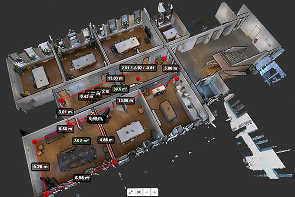
Explore how our point cloud solution Pointorama supports your profession - whether you’re a land surveyor or a real estate professional.

Indoor mapping tool - Pointorama
Pointorama

Save 50‑75% of your typical processing time

Collaborate in real‑time on accurate models with instant updates.

Why Pointorama

Why professionals choose Pointorama?

Precision you can trust

Pointorama delivers the accuracy surveyors demand. Thanks to advanced AI processing and intelligent tools, your point clouds are transformed into clean, precise deliverables. Ready for measurement, analysis or CAD integration. Every click is optimized for maximum reliability, from the first scan to the final floor plan.

Seamless integration with CAD

Pointorama’s export features ensure perfect handover to CAD, BIM and Floorplan Design Tools like Pythagoras CAD. Whether you’re creating detailed floor plans or 3D models, seamless data integration lets you move effortlessly from field data to finalized designs.

Built on 30 years of expertise

Pointorama is developed by the team behind Pythagoras CAD, trusted by surveyors worldwide for over three decades. Their deep understanding of surveying challenges ensures that every tool and feature is designed with real-world needs in mind.

Indoor and outdoor mapping

Whether you’re surveying an industrial facility, a historic building or an open landscape, Pointorama adapts to your environment. Easily switch between indoor and outdoor workflows, with tools built for versatility, precision, and speed. No matter the setting.

Get started

Want to see how Pointorama can elevate your work?

Pointorama makes it easy to transform point clouds into accurate, actionable outputs. Discover why surveyors, AEC experts and real estate professionals trust Pointorama to streamline their workflows.