A practical guide to point clouds and point cloud processing
Point clouds are the foundation of modern surveying and indoor mapping. This article explains how point clouds are created, processed and validated to achieve accurate, survey-grade results, and why proper processing is essential for reliable measurements, floor plans and professional applications.
In this guide
- What is a point cloud?
- How point clouds are created through 3D scanning
- Core elements of a point cloud dataset
- The impact of point cloud accuracy on surveying workflows
- Point cloud processing and accuracy control
- Workflow steps for reliable point cloud results
- Advantages and limitations of point cloud–based workflows
- Point cloud formats and interoperability
- Point clouds in professional applications
- Conclusion
What is a point cloud?
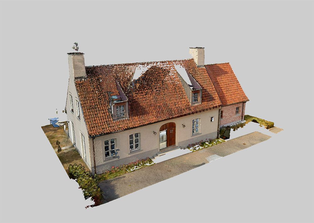
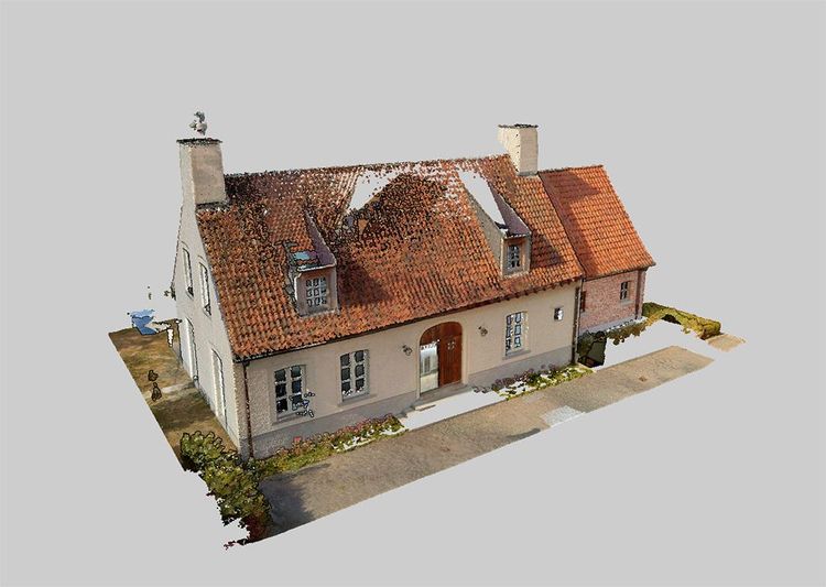
A point cloud is a digital representation of a physical environment composed of a large number of individual points in three-dimensional space. Each point represents a precise location where a surface was detected during scanning.
In surveying and indoor mapping, point clouds describe geometry such as floors, walls, ceilings, structural elements and terrain. Together, these points form a spatial snapshot of the environment as it existed at the moment of capture.
Unlike traditional plans or models, a point cloud is not an interpretation of geometry. It is a direct measurement of reality. This makes point clouds particularly valuable for documenting existing buildings where drawings are missing, outdated or no longer reflect actual conditions.
How point clouds are created through 3D scanning
Point clouds are created by scanning physical environments with 3D scanning technologies that measure distances to surfaces and convert those measurements into spatial coordinates.
Two main capture approaches are used in surveying workflows:
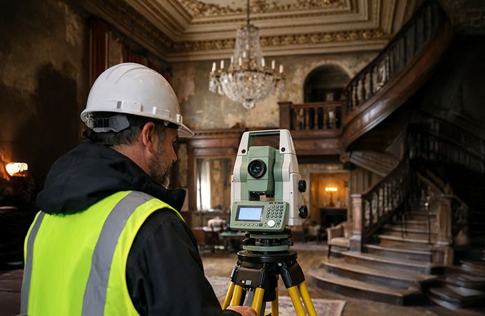
- Static laser scanning (TLS) — Static scanners capture geometry from fixed positions. Each scan records a stable and highly accurate snapshot of the surrounding environment. Multiple scan positions are combined to cover an entire building or site.
- Mobile scanning (SLAM-based) — Mobile scanners capture data while moving through the environment. Geometry is recorded continuously along a trajectory, allowing large or complex interiors to be scanned efficiently.
Regardless of the capture method, scanning produces a raw point cloud dataset. At this stage, the data reflects the environment but is not yet optimized for measurement or analysis.
Core elements of a point cloud dataset
A professional point cloud dataset consists of more than just spatial points. Several characteristics determine its usability and reliability. These elements influence how well the point cloud can be processed and how reliable derived outputs will be.
- Geometric consistencyPoints must align correctly across the dataset.
- DensitySufficient point density is required to represent surfaces accurately.
- Spatial coherenceWalls, floors and edges must form continuous geometry.
- Metadata and structureScan positions, trajectories or additional information support interpretation and processing.
The impact of point cloud accuracy on surveying workflows
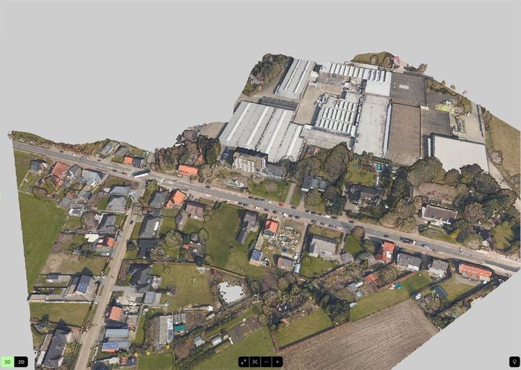
Accuracy is a critical factor in any surveying workflow. For point clouds, accuracy is influenced by both capture and processing.
Static scanning benefits from stationary acquisition, which typically results in high absolute accuracy. Mobile scanning prioritizes speed and coverage, but introduces movement-related effects such as trajectory drift and cumulative positioning errors.
For surveyors, understanding how accuracy propagates through point cloud workflows is essential. Accuracy is not guaranteed by scanning alone — it is achieved through proper processing and validation.
Visually correct is not the same as accurate
A point cloud that appears visually correct is not necessarily accurate. Small misalignments can significantly affect measurements, floor plan generation and downstream use.
Point cloud processing and accuracy control
Point cloud processing consists of a set of digital steps applied after data capture to transform raw scan data into a coherent, accurate and usable dataset. Each step addresses a specific aspect of data quality and directly influences the reliability of measurements and derived outputs.
Together, these processing steps determine whether a point cloud is suitable for professional surveying and indoor mapping workflows.
- Point cloud registrationRegistration aligns multiple scans or scan trajectories into a single spatial reference. Without it, individual scans remain fragmented, making consistent measurement and analysis impossible.
- Trajectory processing and drift correctionIn SLAM-based workflows, scanner movement is reconstructed digitally. Over time, small positioning errors accumulate, leading to drift. Drift correction reduces these accumulated errors and improves global spatial consistency.
- Noise and outlier removalNoise and outliers are points that do not represent meaningful geometry, often caused by reflective surfaces, moving objects or sensor artifacts. Removing them improves dataset clarity and supports reliable measurement.

Workflow steps for reliable point cloud results
Achieving reliable results requires more than technical processing — it also depends on workflow discipline. By combining good capture practices with proper processing, surveyors can significantly improve point cloud quality.
- Planning the scanUnderstanding building layout and identifying areas that may require special attention.
- Capture awarenessMaintaining consistent movement and sufficient coverage during scanning.
- Processing and validationApplying registration, drift correction and cleaning steps.
- Quality controlVerifying alignment and measurement reliability before generating outputs.
Advantages and limitations of point cloud–based workflows
Point cloud workflows offer significant advantages over traditional measurement approaches. Understanding both sides allows surveyors to choose the right approach for each project.
| Feature | RecommendedAdvantages | Limitations |
|---|---|---|
| Geometry | Complete capture of existing geometry | Data quality depends on capture conditions |
| Time & accuracy | Reduced time on site | Mobile scanning introduces drift-related challenges |
| Reuse | Reusable digital datasets | Processing is required to achieve reliable accuracy |
| Outputs | Consistent outputs across multiple representations | Large datasets require efficient software handling |
Point cloud formats and interoperability
Point clouds can be stored in a wide range of file formats, each designed to support different workflows, software ecosystems and data characteristics. The choice of format affects interoperability, processing efficiency, storage requirements and long-term accessibility.
Open and widely adopted formats
- E57: an open, extensible format that supports point data, scan structure and metadata
- LAS / LAZ: open LiDAR formats, with LAZ offering efficient lossless compression for large datasets
ASCII-based formats
- XYZ: simple text-based format containing point coordinates
- PTS: ASCII format storing coordinates along with color or intensity
- PTX: extended ASCII format that can include scan and registration information
Mesh- and library-oriented formats
- PLY: vendor-neutral format often used for polygonal data and visualization
- PCD: format associated with the Point Cloud Library (PCL), commonly used in research and processing workflows
Vendor-specific and proprietary formats
- RCP: associated with Autodesk ReCap
- FLS: used by Faro scanners and Faro Scene
- POD: supported by Bentley Systems
- CL3: generated by Topcon scanners
While many formats exist, professional surveying and indoor mapping workflows generally favor open and vendor-neutral formats. These formats simplify data exchange between different tools, reduce dependency on specific hardware or software ecosystems, and help ensure long-term usability of point cloud data across projects and platforms.

Point clouds in professional applications
Processed point clouds are used across a wide range of surveying and mapping applications. As a consistent and measurable spatial dataset, they provide a reliable reference for multiple workflows.
Indoor mapping and floor plan generation
Processed point clouds form the basis for generating accurate 2D and 3D floor plans. Geometry such as walls, rooms and levels is extracted directly from scanned data, ensuring layouts reflect real-world conditions rather than interpreted drawings.
Surveying and spatial measurement
Once properly registered and optimized, point clouds support reliable digital measurements across an entire site or building. This reduces the need for repeated field visits and enables consistent documentation based on a single dataset.
Renovation and retrofit projects
Point clouds capture the existing condition of buildings as measured geometry. This provides dependable base data for design and planning, reducing uncertainty and limiting rework in renovation workflows.
Facility management and asset documentation
Scan-based spatial documentation supports facility management by providing up-to-date layouts and spatial references for maintenance, asset location and space management.
Scan-to-BIM workflows
In scan-to-BIM workflows, processed point clouds serve as the reference for creating BIM models of existing buildings, reducing assumptions and improving spatial consistency.
Processing is the key to unlocking value
Point clouds have transformed surveying and indoor mapping by enabling fast, complete and reusable spatial documentation. However, raw scan data alone is not sufficient.
Reliable results depend on proper point cloud processing, including registration, drift correction and noise removal. For surveyors, understanding both capture and processing is essential to achieving accurate, survey-grade outcomes.
As scanning technologies continue to evolve, point clouds will remain the foundation of modern spatial workflows — and processing will remain the key to unlocking their full value.
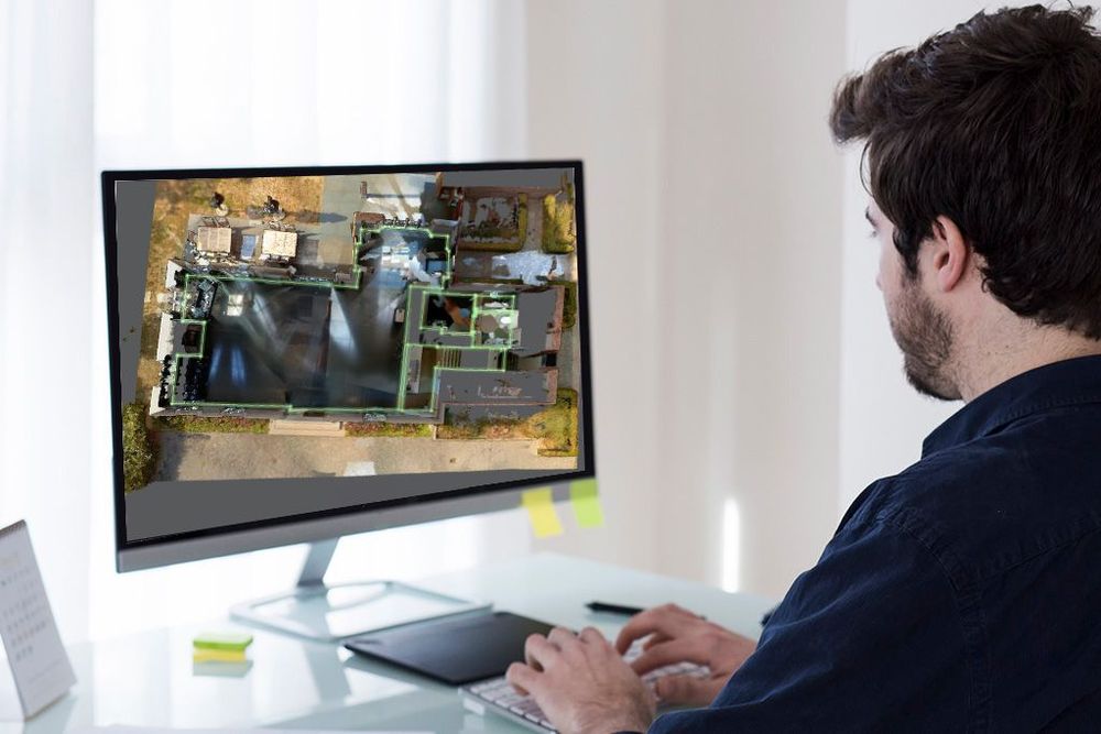
Seamless processing, no matter how your point clouds are captured
No matter how your point clouds are captured — using static scanners or mobile SLAM systems — Pointorama enables efficient processing, analysis and optimization. By focusing on geometry and workflow integration, Pointorama helps surveyors turn raw scan data into reliable spatial documentation.
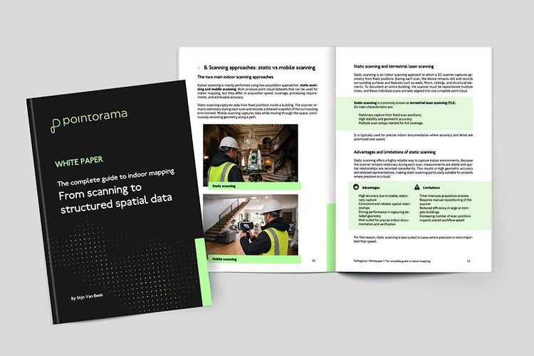
Download your free white paper on indoor mapping
Dive into the fundamentals of indoor mapping and better understand the technology behind the workflow. Download our free white paper and discover how scanning, point clouds and floor plan generation come together.
Related articles
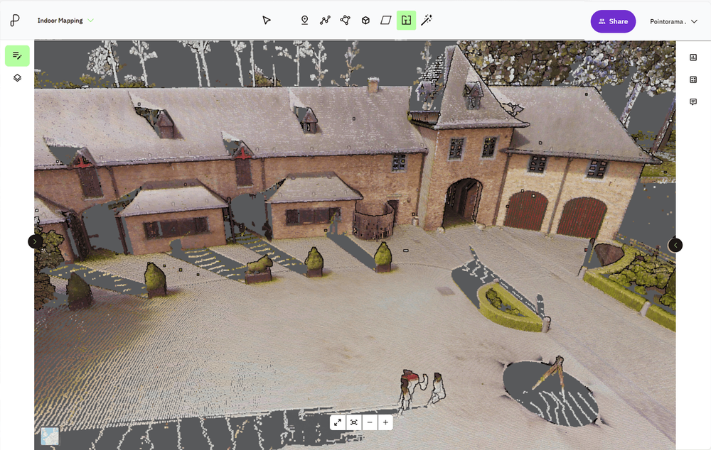
Point cloud registration: what it is and why it matters
At GEO Business we talked a lot about smarter workflows, but it all starts with accurate data. And when working with multiple scans, that means registration. In short: point cloud registration aligns different scans into one coherent 3D dataset - so you can model, measure, and monitor with confidence.
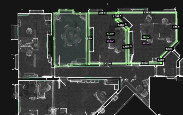
GEO Business 2026 recap: Why our latest Pointorama release turned heads
At GEO Business 2026, Pointorama showcased its latest release, demonstrating how professionals can transform point clouds into accurate floor plans, measurements and deliverables within a single platform. Discover the new features, the industry's biggest challenges, and how AI-powered automation is helping teams work faster and more efficiently.

Innovations at Intergeo '25 – Discover the next features of Pythagoras CAD & Pointorama
Bezoek ons op Intergeo 2025 in Frankfurt en ontdek de nieuwste features van Pythagoras & Pointorama. Vraag je gratis ticket of boek een demo!